
Staying precisely on route can help you anticipate and avoid terrain hazards such as cliffs and avalanche prone slopes. It is also an essential skill if you want to travel to places where there are no trails to guide the way.
Writing a Wilderness Travel Agenda prior to your outing will help you in a number of ways:
i) It will help you set an approximate time agenda for the entire outing. By dividing your outing into several smaller steps, you’ll have a clearer idea of not only whether you are making adequate progress while on the outing, but also whether or not your proposed objective is even “do-able” in the first place.
ii) It will help to familiarize yourself with the terrain details on your map. It is much nicer to look at your map and become familiar with it in the comfort of a warm home than while standing in a rainstorm at a trail junction or route obstacle out in the mountains. If you are traveling either off-trail or in the snow, a Wilderness Travel Agenda will help you more accurately keep track of your position by providing you with predetermined terrain features, map bearings and elevation change information. Trying to calculate map bearings or elevation changes while exhausted from climbing or while standing in a snow storm is not only uncomfortable, it is possibly inaccurate and therefore dangerous. If traveling in potentially hazardous terrain, careful map reading can help you select the route option that offers the lowest slope angle or least potential for avalanches, rock fall, ice fall and/or crevasses.
Once you are experienced with writing Wilderness Travel Agendas, it will take you about 30 minutes to write an Agenda for a typical day-climb or day snow-tour. Even multi-day trips can be written up in about an hour. However, don’t be surprised if your first couple of Travel Agendas take you two hours or more to complete.
The basic steps of writing a Wilderness Travel Agenda (with approximate times for each step) are:
1. Obtain a detailed topographic map
2. Identify key features on your map (5 to 10 minutes)
3. Identify potential route options on your map (5 to 10 minutes)
4. Select and mark your intended route on your map (5 to 10 minutes)
5. Place control dots at direction change locations on your map (5 to 10 minutes)
6. On a blank travel agenda, fill out the Terrain column (10 to 20 minutes)
7. Fill out the Elevation Change column (1 to 2 minutes)
8. Fill out the Distance Change column (2 to 4 minutes)
9. Fill out the Direction column (5 to 10 minutes).
10. Fill out the Time column (2 to 4 minutes)
This may sound like a lot of work, but it can actually save you time during your outing by helping you to more systematically plan and carry out your trip. The following is a closer look at how to do each of these ten steps.
1. Obtain the map. Use the most detailed topographic map for the area you will be going to (usually this will be a U.S.G.S. 7½ minute map...These can generally be downloaded from Topozone.com using the 1:24,000 option).
2. Identify key features on your map. These include potential starting points (ie where you park the car), route objective(s) and key terrain features. I typically mark very steep or avalanche prone slopes (those with two or more contour lines in a sixteenth of an inch) with a yellow marker. I also use a red pen to draw lines down the major ridges.
3. Identify potential route options on your map using available guidebooks, ranger phone calls, friends who have been there, and the topographic map itself. The most common route is not necessarily the safest route. Often it is merely the most direct route. A longer but safer route may be found by staying on the least steep terrain (where the brown contour lines are farthest apart) and on ridges (where the brown contour lines form V’s which point down hill) in order to minimize avalanche hazard and avoid terrain obstacles.
4. Select and mark your intended route on your map (I use a thin green marking pen with the most common route as a solid green line and potential route options in a dashed green line). When choosing between route options, your route will be easier to navigate if you plan your route to utilize potential “baselines” (long features such as streams, ridge lines, tree to boulder field edges) and terrain “helpers” (such as big flat areas or definite changes in slope steepness) which can be followed and used as a sequence of events to frequently confirm your position and help you keep track of your route in the field. (Time for this step will vary from five minutes to one hour depending on the complexity of the trip and your experience at reading maps.)
5. Place control dots at terrain helpers and direction changes. Once the route has been marked on your map, identify a few critical points on the route that involve either a definite direction change or route precaution area (such as a junction with another route) or definite terrain feature (such as where the route crosses a stream, crests a ridge or enters a bowl or passes through a flat area or has a definite change in slope angle). Place control dots on your map at these locations (I usually use a black pen to mark these locations. Try to divide your outing into a small enough series of steps so that you will have enough distinct clues to get from point to point even if you are suddenly caught in a snow storm or white-out. In order to help you re-confirm your position every 30 to 60 minutes, your dots should be no more than one mile apart. Ideally, on a USGS 7 ½ map, you should place control dots every inch (.4 miles) to two inches (.8 mile) apart, depending on the terrain features available and the direction changes required. (This step should take no more than 5 minutes.)
6. Fill out the Terrain column. On your Travel Agenda (see last two pages of this hand-out), fill out the entire second column by writing in the terrain features at and between each control dot. Use parentheses for the approximate elevation (within one contour line or 40 feet) of each dot. (This step will take 5 to 10 minutes.). Example: From the Paradise Visitor’s Center (5400), ascend ridge E. of Deadhorse Creek to flat area (5520).
7. Fill out the Elevation Change Column. Once the Terrain column of the Travel Agenda has been completely filled out, use the elevations of each dot and subtract the elevation of the previous dot to determine the Elevation Change. Fill out the Elevation Change Column completely. When descending, put the elevation drop in parentheses to indicate a loss of elevation rather than a gain. (This step should take no more than a couple of minutes.)
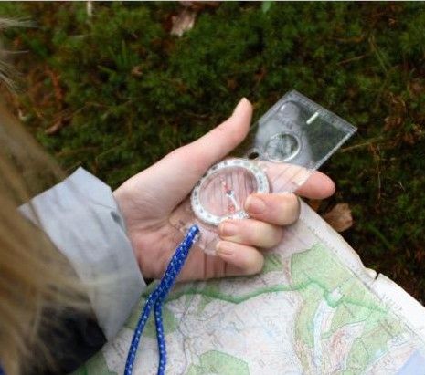
8. Fill out the Distance column. The goal of using a travel agenda is to keep track of your position to within one tenth of a mile or within ¼ inch on a 7 ½ minute topo map ( an area about the size of a football field). Using the long or short edge of your Compass and the mileage scale marker at the bottom of your map, determine the distance in tenths of a mile between each big dot and completely fill in the Distance column on your Travel Agenda. On a U.S.G.S. 7 1/2 Topo map, each quarter inch equals one tenth of a mile. So if two points are an inch apart, then write .4 miles in the appropriate box on your Agenda. (This step also should take no more than a couple of minutes.)
9. Fill out the direction column. Using either long edge of your Compass, determine the average map bearing from each control dot to the next dot and fill in the direction column of your Travel Agenda. Because you will be using the terrain features more than the compass bearing, it is not necessary for your bearing to be very accurate. If fact, I usually just list the bearing to the nearest 5 degrees. Once you have done several map bearings with a compass, you should be able to simply guess the map bearing from one dot to the next within 5 degrees by simply looking at the dots. (This step should take from 5 to 10 minutes...with practice. You should be able to take an accurate map bearing in under 30 seconds and guess the map bearing in under 10 seconds.)
10. Fill out the Time column You can base your time estimates on the following factors:
i) the distance between dots
ii) the elevation change between dots
iii) the difficulty of the terrain
iv) the physical condition of your weakest group member
v) the skill level of your least skilled group member
vi) the worst possible weather conditions which might be anticipated
vii) the altitude you will be at (if above 6000 feet)
viii) the number of people in your group
ix) the amount of weight being carried in each pack
x) ascending vs. descending.
The following guidelines can help you estimate times for each section of your Agenda:
i) Distance Between Dots. A typical group of four to eight people can travel up to 2 miles per hour on flat terrain with no obstacles. Travel on snow may reduce this slightly. Cross-country travel may reduce the rate down to 1 mile per hour or less depending upon the density of the brush. Using the chart below, simply multiply the distance listed in the Distance column by which ever rate of travel you feel you team will maintain. EXAMPLE: If you assume an travel rate of 1.2 miles per hour, then you can use a time estimate of five minutes for each tenth of a mile (i.e.: If you are traveling four-tenths of a mile from point A to point B, then you would estimate a time of 4 x 5 minutes or 20 minutes).
-
TRAVEL RATE
TIME PER MILE TIME PER EACH TENTH MILE 1.0 MPH 60 MINUTES 6 MINUTES 1.2 MPH 50 MINUTES 5 MINUTES
1.5 MPH 40 MINUTES 4 MINUTES 2.O MPH 30 MINUTES 3 MINUTES
Example: Let’s say we are estimating the amount of time it will take our group to travel from the Paradise Visitor’s Center (5400) to Deadhorse Creek (5800). The distance is .4 miles. The elevation gain is 400 feet. At a distance travel rate of 1.2 MPH, .4 miles =4 x 5 or 20 minutes. At an Elevation Ascent Rate of 600 feet per hour, each 100 feet would take 10 minutes. 4 x 10 = 40 minutes. The total time estimate would be 20 minutes plus 40 minutes or 60 minutes. I have personally traveled this terrain section with nearly 100 different groups over the past twenty years. The quickest group took barely 15 minutes. The slowest group took well over an hour. The average time has been 50 minutes.
iii) Difficulty of Terrain. There are no boulder fields, brush, cliffs, or river crossings between the Paradise Visitor’s Center and Deadhorse Creek. An old saying is that “Two miles on a trail is quicker than one through the brush.” The truth is there are many different kinds of “brush.” Some brush is so dense even rugged climbers would be hard-pressed to gain two miles a day! By contrast, walking on a fisherman’s path through High Alpine meadows is not much slower than walking on a maintained trail. The key to avoiding the densest brush is to avoid traveling near water sources that lead to the growth of dense brush. This means avoiding creek bottoms. Plan your route on ridges or, where ridges are too steep, use the wide shoulders part-way up the ridge. Valleys should be considered the “route of last choice “unless you are on a maintained trail or other pre-determined route. If a given section of your route involves obstacles such as brush or steep areas or tricky route finding, multiply your time estimate for that section by up to two.
iv) Physical Condition of Your Weakest Group Member. It is wise to get to know your group members on easier outings prior to taking them on more difficult outings. During the easy outing, try to determine the limits of your group members by traveling at a pace which is greater than the fastest pace needed for the more difficult outing. Maintain this fast pace for at least 60 consecutive minutes (stopping after the first five minutes for a foot check and clothing break. Thereafter stopping only every 30 minutes for 1 minute water breaks). During these “test” outings, encourage group members to carry packs which would be similar in weight on the uphill portion of the outing to the weight of their packs on the more difficult outing. This is most easily done by carrying several full quart water bottles (which weight 2 pounds each) on the ascent portion of the “test” outings and then dumping out most of the water when the high point is reached. This will help you determine your group’s limits while saving the group members’ knees for the actual difficult outing itself. During the more difficult outing, you can increase the group’s ascent rate by minimizing the group gear carried by weaker group members and dividing it instead among the stronger members of the group.
v) Skill Level of Your Least Skilled Group Member. This consideration is particularly important for writing up Travel Agendas for Rock Scrambling and Ski Outings. A good skier can travel over 4 times faster than a novice both going up and down a slope. Similarly, someone with good balance and experience can “boulder-hop” their way up or down a boulder field many times faster than someone who has is not familiar with this skill.
vi) The Worst Possible Weather Conditions Which Might Be Anticipated. Bad weather can slow your progress during the winter time or at altitudes above 6000 feet during the summer time by snow covering up your route, white-outs limiting visibility and/or winds and rain robbing your group of their energy and strength. You should allow for this by using even more conservative estimates (reducing your estimated ascent rate by up to 100 feet per hour), choosing more conservative objectives or using earlier start times during winter or high elevation outings.
vii) Altitude of the Outing (if above 6000 feet). The oxygen in the air starts dropping above 6000 feet and really starts dropping above 10,000 feet. The following chart illustrates how altitude affects the ascent rate of a “typical” group of 4 to 8 well-conditioned hikers with daypacks or overnight packs:
-
ElevationAscent Rate Per Hour
with DaypacksAscent Rate Per Hour
With Overnight PacksBelow 6000 feet 1000 feet 800 feet 6000 to 10,000 900 feet 700 feet 10,000 to 12,000 800 feet 650 feet 12,000 to 14,000 600 feet 500 feet
viii) The Number of People in Your Group. Groups of larger than twelve are not recommended on wilderness outings...not only because of minimum impact and wilderness regulation concerns, but also because large groups tend to travel so slowly that little forward progress can be made leading to frustration within group members and the tendency for the group to get split up (with associated communication problems). Assuming that each member of a group will have 3 minutes of “problems” (lacing boots, readjusting pack, clothing adjustments, nature calls, etc.) per hour, you only need to allow 12 minutes for “problems” with a group of 4 (48 minutes of travel time). However, if you have a group of 12, you will have 36 minutes of “problems” and thus the time left for traveling might be cut in half (24 minutes per hour) and your time taken to complete the outing can be as much as doubled.
ix) Weight Being Carried in Each Pack. A typical daypack weighs about 20 to 25 pounds. A typical overnight pack might weigh 40 to 50 pounds. A typical wilderness traveler will weigh 130 to 160 pounds without their pack. With a daypack, they will weigh 150 to 185. With an overnight pack, they will weigh 170 to 210. This represents a total weight increase of about 20% when carrying an overnight pack instead of a daypack. This will mean an increase in energy expended of 10 to 20%. You should therefore reduce your expected elevation gain by 10 to 20% (from 1000 feet per hour to 800 feet per hour) and increase your time allowed by 10 to 20% depending on your group and the outing. One exception to this rule is that, when traveling on flat or gentle terrain on a trail, most folks can carry an overnight pack about as fast as they can carry a daypack (about 2 MPH).
x) Ascending or Descending. Provided that your group has been taught “efficient descent techniques” such as side-hopping and fluid motion, you can generally assume a descent rate of twice as fast as your ascent rate. I therefore calculate each ascent rate from big dot to big dot to the high point of the outing, and then divide each of those times by two to estimate the times back down. Exceptions to this rule include:
a) Novice skiers may actually take longer to go down than they took to go up!
b) Really advanced skiers...who can descend a slope at a rate of up to 5,000 feet per hour!... or 5 times faster than they took to go up! (Step 8 should take five to ten minutes allowing you about one minute to decide what ascent rate you will use).
Once you have determined approximate time estimates for each section of the outing, you can add them all up to determine your estimated total outing time (be sure to add 30 to 60 minutes for one or two “lunch” breaks during the day. Subtract the total outing time from the time you wish to be back at the trailhead to arrive at your starting time. Subtracting 30 more minutes from this will give you the time you should arrive at the trailhead (to allow for trailhead activities such as stretching, lacing up boots and putting on sunscreen). Adding the driving time to the trailhead from town will give you your departure time from town. You can then use all of this information to finish the “time” column of Wilderness Travel Agenda and you are now “ready” for your outing!
Of course your Travel Agenda won’t do you much good if you can read it and don’t use it, so make sure you put it in a large zip lock bag and find an accessible place for it on the outside if your pack.
WILDERNESS TRAVEL AGENDA
Trip Name_____________________Map(s)
Driving Directions:
Driving Time:
TIME |
TERRAIN (elevation) |
ELEVATION CHANGE |
DISTANCE (MILES) |
DIRECTION |